Saturday Pond Facts
Restrictions: No Personal Watercraft (a.k.a. Jet Ski)
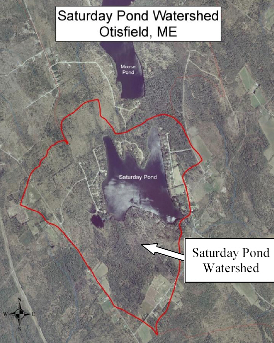
Area:179 acres
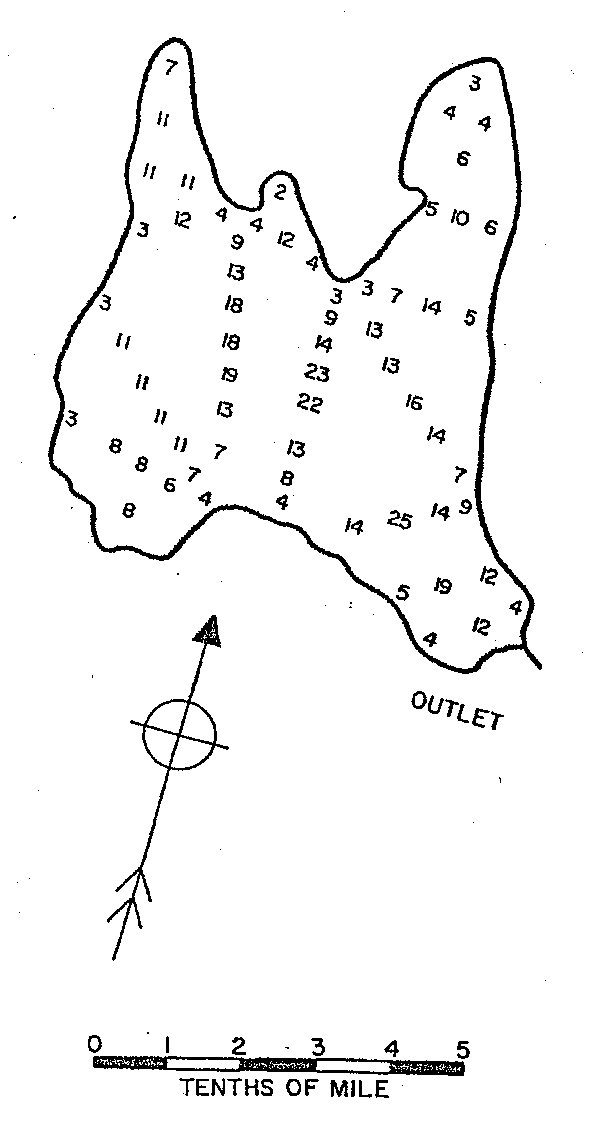
Maximum depth: 25 feet
Town: Otisfield Maine
County: Oxford
Public Access:
- From the Rayville Road side - Sam's Landing
- Residents and Taxpayers only
- Hand carried boats only
Outlet: Sucker Brook into Thompson Lake
Inlet: Multiple unnamed streams and runoff
Elevation: Water level is 530 ft above sea level
GPS Coords: 44.11 N, 70.56 W
MIDAS number: 3440
Pond Depth in Feet: